


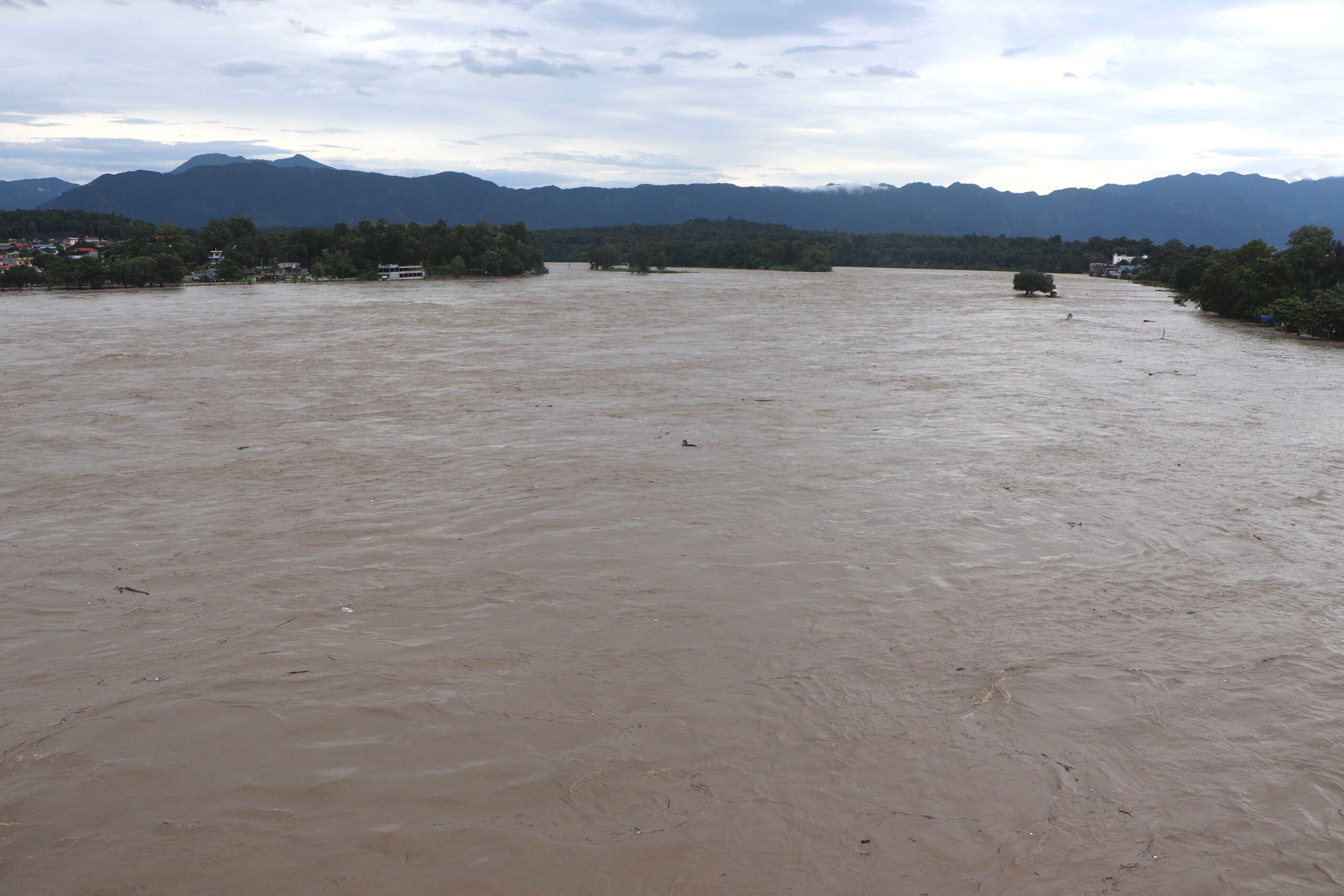
Kathmandu. It is not appropriate to consider the Bhotekoshi disaster as just a normal flood. It is not a flood, it is a mountain catastrophe. The snowfall and rock of the Himalayas hit the river and lake, all of them were washed away and there was a deluge with stones and mud. Such an incident is a very rare incident in the history of disasters in the world. Due to environmental destruction, such problems are likely to increase in the coming days. In a less developed and poor country like Nepal, such incidents have caused great damage physically, humanly and socially. The preliminary estimate of the damage caused by the Bhotekoshi flood from Rasuwagadhi to the coastal area is about four trillion rupees.
According to the Rapid Damage and Needs Assessment (RDNA) report of the disaster, it is estimated that Rs 723.31 billion will be required for reconstruction and rehabilitation. It is a matter of economic loss. The kind of human loss caused by the floods, the disintegration of families, the loss of children, the destruction of large, transformative infrastructure projects like hydropower has had a long-term negative impact on the families and the national economy.
A few days after the incident, I reached the affected area. I gave my suggestions to the stakeholders there as well. Now I want to tell the government and other agencies that after learning from this disaster, the entire country should make a land use plan keeping in mind the mountains that will melt in the coming days and there is a high risk of such a disaster. Which place should be used for what? Scientific research should conclude which geography is suitable for settlements, which is suitable for agriculture, which is suitable for industry. Only on these grounds should the path of development be taken forward. Being a student of urban and regional development planning myself, I feel that it should start from the Trishuli Corridor. A master plan should be prepared in an integrated manner of the Trishuli Corridor.
Along with the rehabilitation of all the citizens who have been displaced by the disaster, that corridor should be developed in a new way. This area is also a historical and important road close to Kathmandu and connected to China. Therefore, by learning the lessons from the damage caused by this disaster, we should be able to take forward the Trishuli Corridor as a model development area in the coming days. Should we build settlements in the same place again? This question may arise. Normally, when there is a flood, the concept is 10-15 meters maximum and 20 meters, but this time the flood has come up to 100 meters in some places. Now it is not possible to reach 100 meters everywhere. However, now it has taught a lesson. Therefore, settlements should not be built by sticking to very steep areas and river banks. Yesterday, we did not make sense. According to the land use plan, we did not distinguish the settlement area, the agricultural area, the area for the construction of development infrastructure. Due to this weakness of the past, there was a huge loss of life and property this time. Therefore, now the geological and topographical survey should be done first. Only then will the high use of current science and technology find out which land is suitable for what. Now development should be done only on that basis by mapping.
After such a huge loss in a single incident, the question may arise as to where to get the resources for reconstruction. Ours is a country where the per capita gross domestic product (GDP) is far behind. Because of this, it is difficult to compensate for the damage caused by the Bhotekoshi floods easily. However, we should not always beg for help from each other. Therefore, now we have to properly organize and prioritize our internal resources. Secondly, this event is a catastrophe brought about by climate change. There is also a provision to get compensation from an international conference. If we can take forward the issue of compensation by going through some process, then that resource can be mobilized. In addition, it is better to take the insufficient resources in the form of assistance from various friendly countries, a little long-term help in the form of low interest. But, mainly, we have to depend more on our own resources.
The use of natural materials that have been washed away by the floods can be another way for reconstruction. Basically, the flood has piled up mud with stones and pebbles. Some of the natural materials that came with the flood are already used. When reconstructing the affected areas, the same resources can be used and the people displaced by the floods can be mobilized as necessary workers. Especially in Rasuwa, the villages have been displaced. There is no place to live in the village. In such places, industrial centers can be built and employment can be given to the displaced. In such a situation, the citizens do not even have to go abroad in search of employment. They get employment at home. In this way, the state does not have to keep the displaced citizens forever. On the other hand, it is appropriate to employ the same displaced people in such development works. This disaster can be taken as an opportunity if we go about using local resources and human resources instead of giving contracts from outside, giving contracts to others, and bringing workers from there.
There is also a need to rethink the model of development. The kind of tunnels we built in the hydropower project, no one thought that such a disaster would come. Now, even while constructing tunnels, we have to build them keeping in mind the geography and potential disaster. The only thing we can do is to build so many projects so close to the river, so the risk of damage is high, so we should not repeat that mistake. Now, there should be no settlements in such riverine areas. It will be a big mistake if we allow urbanization on the river banks as before. We should learn from this and move forward. Now there are some big flat tarps or forested areas in the upper part, instead of planting forests in the areas of the river banks, we can plant forests in the areas of the river banks and deforestation in the areas where there is forest. For this, I am trying to make a comprehensive land use plan. The old land use plan was not in a systematic way, now emphasis should be given on the development of well-managed settlements in a new way.
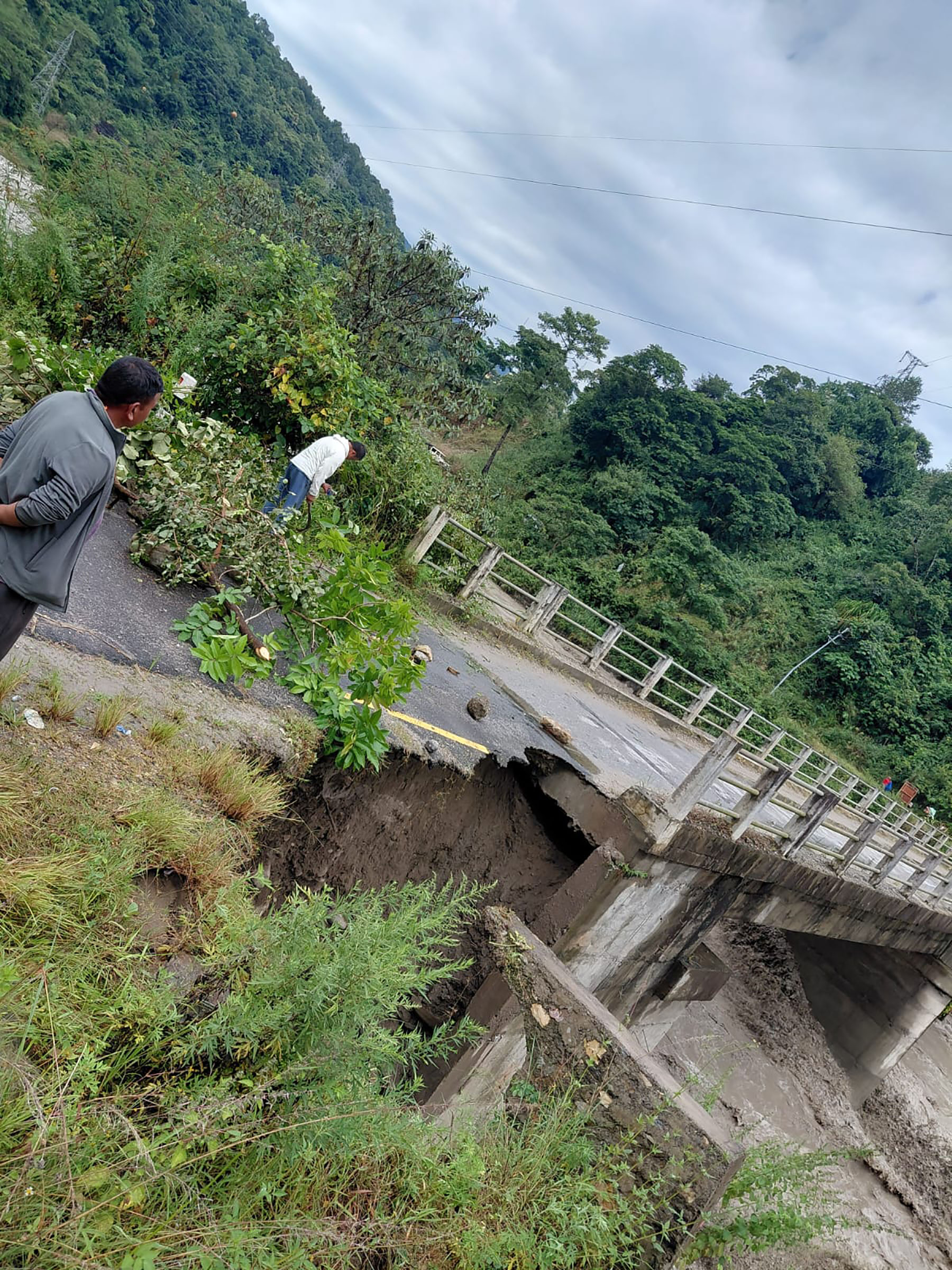
While reconstructing infrastructure in the areas affected by the Bhotekoshi floods, long-term and sustainable development should be given priority along with immediate relief. Keeping in mind the risk of floods, the reconstruction of roads, bridges, hydropower projects, schools, health institutions and settlements should be done on the basis of scientific study and selection of safe places. Special attention should be paid to not encroach upon the natural flow area of the river, build embankments and protection structures, and make the early warning system effective. If systematic settlements, agriculture, and infrastructure can be built in the Trishuli Corridor, it can become a model for the country. The way the settlements have expanded on the banks of big, medium and small rivers and rivers of the country, it is sure to cause huge loss of life and property in such disasters. Taking lessons from this incident, it can become a model for hundreds of other places to make arrangements for safe settlements. Therefore, reconstruction should be carried out with the participation of the local community, transparent planning and coordination between the federal, provincial and local levels. At the same time, we need to develop climate-change-resilient and risk-resilient infrastructure to reduce the damage caused by such disasters in the future.












प्रतिक्रिया दिनुहोस्